
Aerial Land Surveys in East Hampton, Southampton, Westhampton, and Beyond
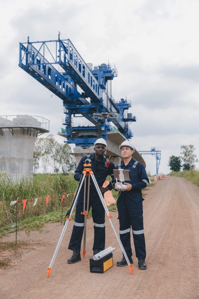
Land surveys provide important data used in construction, property assessments, mortgage deeds, agriculture, health and safety, and many other industries. Aerial land surveys – using tools like drone, LiDAR, and other technology – provide very precise data that can help your project move forward.
Here at Aerial Land Surveying, we provide surveys in the Hamptons to support your project’s goals. From boundary surveys to topo surveys to stakeouts, FEMA elevation certificates, and more, our team is committed to providing you with a broad range of services based on your specific requirements. Reach out to us today at 833-787-8393 for an estimate, or use our online form and one of our team members will respond soon.

State of the Art Technology
Our top tier equipment allows us to collect unlimited aerial data in a fraction of the time.

Hybrid Data Collection
You receive optimal insights through a combination of ground-based and aerial data collection techniques.

Constant Contact
Get immediate responses to questions that arise and stay in the loop throughout the whole process.
Types of Aerial Land Surveys We Offer at Aerial Land Surveying
Every project requires its own unique data that is collected as accurately and efficiently as possible. Land surveys that use aerial technology are able to collect data that suits your project’s goals and moves your data collection needs forward.
Every project requires its own unique data that is collected as accurately and efficiently as possible. Land surveys that use aerial technology are able to collect data that suits your project’s goals and moves your data collection needs forward.
Our goal is to deliver data that exceeds your expectations, with a wide range of survey options available for those in the Hamptons on Long Island including, but not limited to:
– Boundary Surveys – One of the more common uses of land surveys in the Hamptons is to identify boundary lines. This is often used to solve disputes, ensure compliance with zoning laws, and identify the property boundaries for legal and financial matters.
– Mortgage Surveys – Often referred to as “title surveys,” these types of land surveys make sure that the property lines match what is on record, including encroachments and any other items that might affect the value of needed to calculate a mortgage or transfer a title.
– Topo Surveys – Aerial land surveys are often used to create 2D models of 3D land, depicting contours and various natura and manmade features. By using aerial technology, surveyors are able to see the land from above for excellent precision.
– Spot Elevation Surveys – Aerial spot elevation surveys are designed to help identify the height of one part of the property as it compares to either another part of the property or a specific spot on a map, such as how it compares to sea level.
– Property Corner Stakeouts/Markouts – When an organization needs to flag the corners, they often turn to Aerial Land Surveys to allow them to “flag the corners’ and place physical, visible markers around property lines. Useful for installing fences and other structures.
– Health Department Surveys – The Health Department may request that a property in the Hamptons be reviewed for possible public health risks, either on the property or nearby. Aerial land surveying is an effective way to see land from all angles.
– Permit Surveys – Before you’re able to get permits for property additions, you may be recommended or required to obtain a permit survey. This survey may also be used retroactively for unpermitted installations.
– Architectural Surveys – When architects are planning lots, they may be in need of architectural surveys, which can be used to plot utilities and other underground systems.
Many surveys benefit from being conducted with aerial technology. Our team is skilled, available, and ready to efficiently help you move forward with your project. Contact us for most of your land survey needs, as we are able to provide many types of surveys beyond those listed above, including:
– ALTA Surveys (American Land Title Association Surveys).
– FEMA Elevation Certificates
– Lot Split Surveys
– Property Corner Monument Installs
We are your resource for surveys and survey data. Please do not hesitate to contact us with thoughts or questions about what we offer.
Ask About Our Builder’s Package
One service that we’re thrilled to offer here in the Hamptons is known as our “Builder’s Package.” Our Builder’s Package includes many of the land surveys that developers and builders in the Hamptons need to complete their project, including an initial existing conditions survey, a foundation stakeout, and a final survey.
If you’re a contractor here on Long Island, we encourage you to ask us about this package and explore your survey options.
Serving the Hamptons and Throughout Long Island
Aerial Land Surveying is an aerial survey company located on Long Island. We serve the region and parts of New York City. Our work often takes us to the Hamptons, as the Hamptons often have architects and land planning that require and benefit from these types of surveys. Aerial Land Surveying is aware of building department requirements in this region pertaining to coverage limits and clearing calculations.
We encourage you to contact us to matter where you are on Long Island, but especially if you are in places like:
- East Hampton
- Southampton
- Westhampton
- Sag Harbor
- Montauk
- Water Mill
- Bridgehampton, Amagansett, Quogue, and Many Others
Those that are located within the Hamptons – and those close by – should consider contacting our team here at Aerial Land Surveying today to learn more about our services or schedule a time for us to come out to your location.
Let’s Get Started
Aerial Land Surveying is here to help you with your next project. When you need surveys in the Hamptons, or you’re looking for additional data for your land survey projects, reach out to us today via our online form and one of our team members will contact you right away.
get in touch
Aerial Land Surveying has provided expert land surveyors to countless property owners in New York, and we can’t wait to include you among them.
Whether you’re interested in gaining information about your property and its surroundings, or want advice from a survey company near you, we got you covered.
For more specific projects, please fill out the form below.