
Obtain Surveys in the Southampton Area for Property Lines and More – Call Now
It is not uncommon for organizations, property owners, and municipalities to require land surveys. Surveys are used in mortgage deeds, construction, property assessment, even health and disaster analysis.
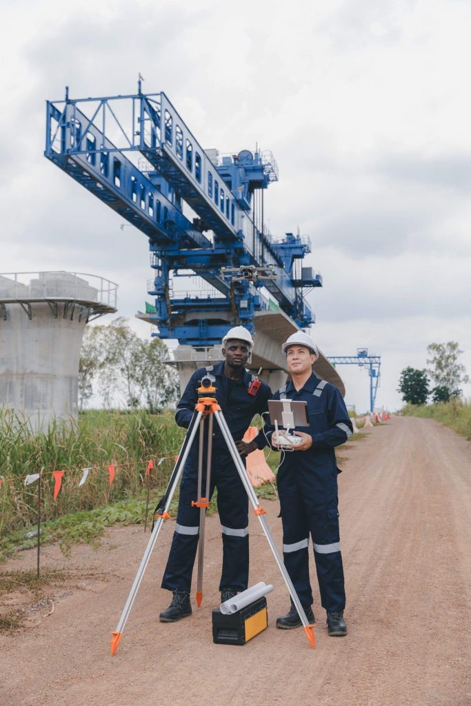
One way to obtain the data required to complete these projects is to utilize aerial
technology, such as drones and LiDAR. At Aerial Land Surveying, this is what we
provide across Long Island, with a special emphasis in the Southampton area. We are often contacted regarding boundary surveys, stakeouts, topo surveys, permits, and more, all to provide you with accurate data you can use to complete your project.
Aerial Land Surveying is here to help you with your next survey. If you’re working on a project in Southampton, or you’d like inquire more about our services and surveys, contact us at 833-787-8393 or fill out our online form to get started.

State of the Art Technology
Our top tier equipment allows us to collect unlimited aerial data in a fraction of the time.

Hybrid Data Collection
You receive optimal insights through a combination of ground-based and aerial data collection techniques.

Constant Contact
Get immediate responses to questions that arise and stay in the loop throughout the whole process.
What Types of Surveys Do We Offer at Aerial Land Surveying?
Many surveys can be completed using aerial technology, which provides very precise data and can maneuver successfully across varied or uneven terrain. Many surveys in Southampton find that they benefit from this type of survey data, as it can support
projects that require:
- Boundary Surveys
- Mortgage Surveys
- Topographic Surveys
- Spot Elevation Surveys
- Property Corner Stakeouts
- Health Department Surveys
- Permit Surveys
- Architectural Surveys
- ALTA Surveys (American Land Title Association Surveys).
- FEMA Elevation Certificates
- Lot Split Surveys
- Property Corner Monument Install
We work with individual homeowners and home buyers, mortgage and title companies, contractors, developers, engineers, architects, expediters, municipal organizations, and more. If your project requires a land survey or would benefit from aerial survey data, give us a call and our team will be here to support it.
About Our Builder’s Package
We also have a “Builder’s Package” that many be beneficial for those that require multiple common surveys at once. Our Builder’s Package includes many of the land surveys that builders require, including a conditions survey, foundation stakeouts, and more. We encourage you to reach out to learn more about this package to determine if it is suitable for your needs.
Get Started with Aerial Land Surveying
Aerial Land Surveying provides survey data throughout Long Island, with much of our work bringing us to the Hamptons. We encourage you to reach out to us to inquire about any project you may need to undertake, and we’ll discuss the different options available, prices and costs, and what makes the most sense for what you need.
For aerial surveys in Southampton, or to inquire about our survey data, please reach out to us today.
get in touch
Aerial Land Surveying has provided expert land surveyors to countless property owners in New York, and we can’t wait to include you among them.
Whether you’re interested in gaining information about your property and its surroundings, or want advice from a survey company near you, we got you covered.
For more specific projects, please fill out the form below.